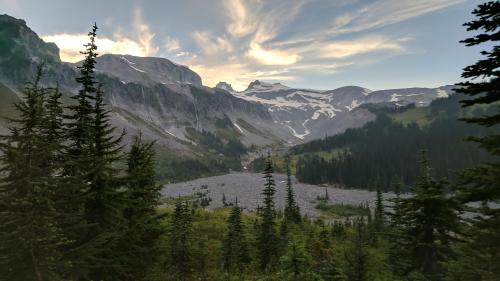
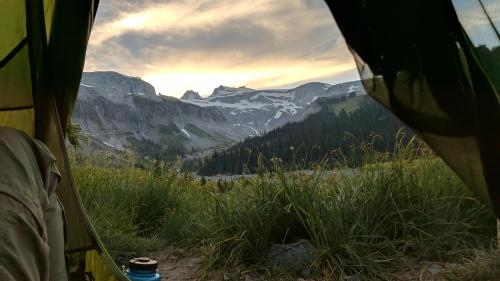
According to the ranger, this is the “best campsite in the park”. I am not sure how we scored this golden ticket, but we were assigned to the group camp at Indian Bar Camp for our first night in the park. The site offers some shade inside the wooden shelter, and nice flat platforms in front with views of the creek and huge views of a giant ridge capped by the Ohanepecosh Glaciers.
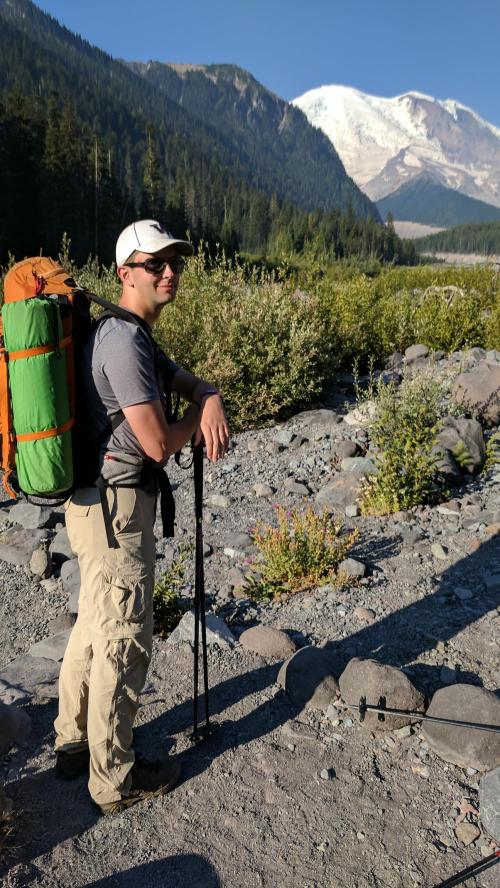
Our day started bright and early with the drive to the trailhead and then a short wait at the ranger station to pick up our permits. We finally hit the trail around 11am. It was Sunday and the White River Campground and parking lots were absolutely packed. It always feels good to shoulder the pack and take those first few steps on the trail. The trail immediately descends to the White River and crosses it via a pair of log bridges. We got our first hazy view of the mountain, looking up the river bed toward the Emmons Glacier.
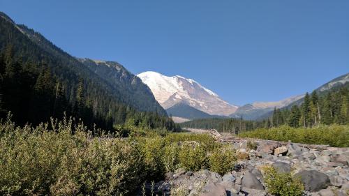
The White River is one of the grand rivers produced by the snow and glacier melt from Mt. Rainier. The rivers carve silty, meandering channels and radiate outward from the mountain. In order, the major rivers and creeks are the White, Cowlitz, Nisqually, Kautz Creek, Tahoma Creek, Puyallup, Mowich, Carbon, and Winthrop. The rivers and creeks are separated by ridges and some of the rivers have two forks separated by a ridge or sizeable moraine. The experience of the Wonderland Trail consists of climbing and descending two or more ridges per day with each ridge having 2000-3000 ft of elevation gain. The ridges are generally at 4000-5500ft and the valleys at 1500-2000ft of elevation.
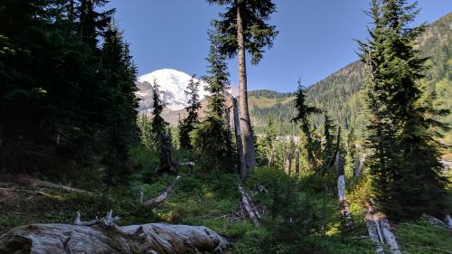
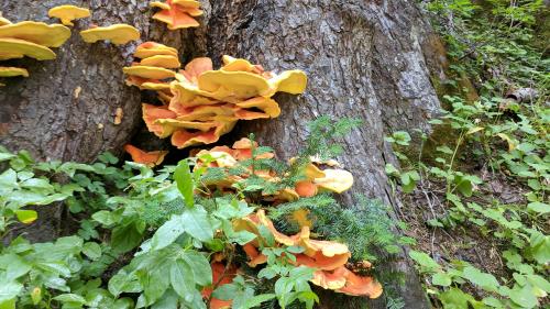
After crossing the White River, the trail is level for several miles through some of the most magnificent forest of the entire trip, a beautiful mix of hemlock, fir, and cedar trees. Nathan told me the myth which relates how you can tell the difference between hemlock and fir cones. The fir cones can survive very hot forest fires so when there is a fire, all the mice climb inside fir cones and hide until the fire is passed and that is why the fir cones look like they have little mouse tails protruding from them.
Fryingpan Creek
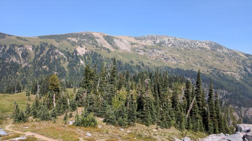
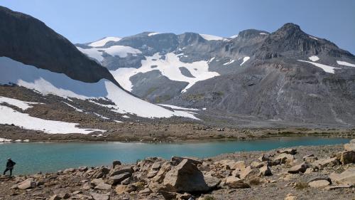
Soon we reached the Summerland trailhead and the trail became crowded once again. The Summerland trail is a fine example of a trail which traverses through all of the different elevation zones on the mountain, starting at low elevation forest and ascending to gorgeous meadows and eventually topping out at Panhandle Gap in a zone of barren rock and snow. We had lunch at a creek near the Summerland Meadows. Temperatures moderated as we passed a series of deep blue tarns below the pass. We saw a few herds of mountain goats on shaded snowy slopes on the far sides of the tarns.
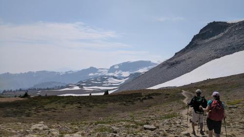
Entering Summerland
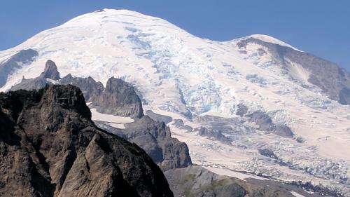
Emmons Glacier
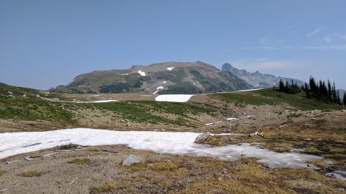
Goat Island Mountain
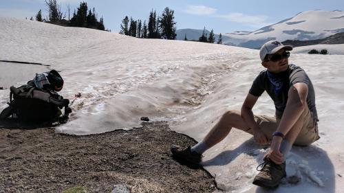
Panhandle Gap and Ohanepecosh Park were some of the very few places where we encountered snow. The last pitch before Panhandle Gap was a narrow snow slope with steep drops on one side. There was only room for one hiker either climbing or descending, the only place that felt a bit like mountaineering. At the top of the pass, we got our first hints that the clear weather would be ending for awhile. All views around us became more and more smoky as we hiked.
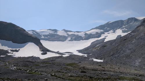
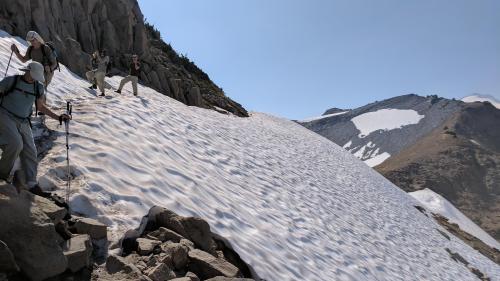
Approaching Panhandle Gap
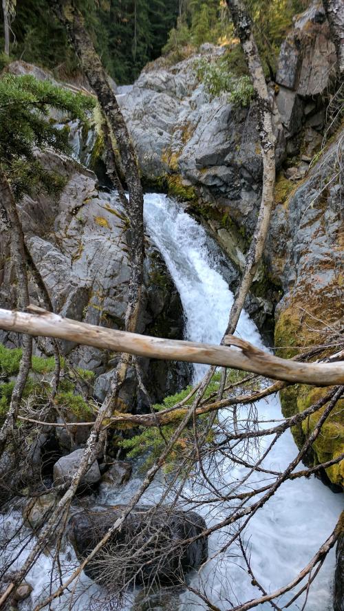
Nathan was starting to doubt whether he was in condition to complete the hike and started to lag behind a bit as we ascended the ridge above Indian Bar. As we descended toward camp, we gazed at a towering cliff wall which formed the head of the hanging valley. Waterfalls were all around tumbling over various faces of the cliff.
Banshee Peak and Cowlitz Chimney
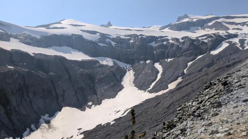
Head of the valley above Indian Bar
After we set up camp, I scrambled down a gulley to the base of a thundering falls (Wauhaukaupauken Falls) and washed myself off in the pool. We agreed that Nathan get a night of sleep and see how he felt about continuing in the morning. There really wouldn’t be any good places to turn around for the rest of the trip. We cooked and did our chores and went to the sleep with sound of the nearby creek tumbling over rocks, distant waterfalls spraying, and a nice breeze blowing up the valley and whistling off cliff walls.
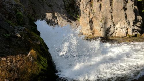
Outflow from Wauhaukaupauken Falls
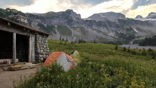
Indian Bar group camp site

Leave a comment